Reno Tahoe International Airport (RNO)
Orientation and Maps
(Reno, Nevada (NV), USA)
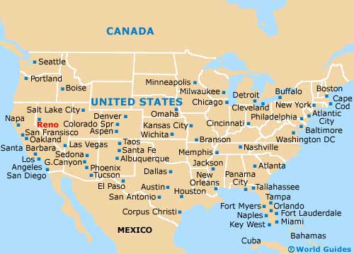
A smaller and more restrained version of Las Vegas, Reno is also located in the state of Nevada, around 450 miles / 725 km from Las Vegas. Reno still has plenty to offer in the way of casinos and bright lights, with the city's visitors center being a good place to stop off, along North Center Street.
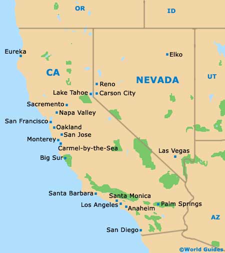
Reno Tahoe Airport (RNO) is located on the southeastern side of the city, off the US-395 highway. Those arriving by Greyhound buses will find the terminal along Stevenson Street and regular buses travel to and from San Francisco, Las Vegas and Los Angeles, amongst other locations. Amtrak trains also provide long-distance travel and operate from the rail station on East Commercial Row.
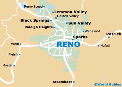
Reno Tahoe Airport (RNO) Maps: Important City Districts
Reno's downtown district is situated on the northern side of the Truckee River and on the southern side of the I-80 interstate. The main action here can be found along Virginia Street, which stands between both 1st Street and 6th Street. Here you will find the main casinos, hotels and dining venues, together with the Nevada Historical Society Museum. Nearby, West Liberty Street is home to the popular Nevada Museum of Art, while the National Automobile Museum is sited along Lake Street.
The city of Sparks lies to the east of Reno, off the I-80 and Prater Way, a major east-west artery in this part of Nevada. Sparks encompasses Spanish Springs and Wingfield Springs and is often referred to as Reno's twin city.
USA Map
Nevada Map
Reno Map